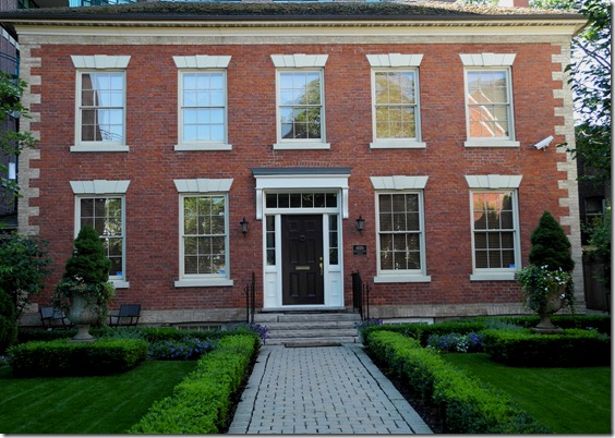
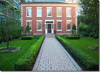
The Farr House on Queen St. West, across from Trinity Bellwoods Park.
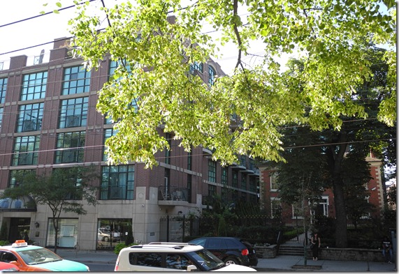
The Farr House is set back from Queen Street, to the west of the Trinity Park Lofts
The Farr house escapes the attention of many people as it is tucked back from Queen Street, on the west side of the Trinity Park Lofts. However, when the house was built, it was on a rise of ground that overlooked the valley where Garrison Creek flowed southward on its course toward Lake Ontario, where it emptied into the lake beside the garrison at Fort York. This is where the stream derived its name.
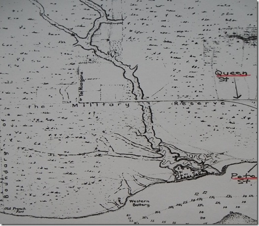
The above map from 1818 depicts the path of Garrison Creek, which at its southern terminus surrounds the timbered walls of Fort York on its east and northern sides. The line on the map marked as “Military Reserve” was Lot Street, which today is Queen Street West. The Farr House was located where Garrison Creek crossed over Queen Street. The creek originated from two sources, and flowed approximately 4 1/2 miles from either of its its sources to its destination in the lake. The eastern source was near Vaughan Road and Cherrywood Avenue, close to where Humewood School is located today. The western source was a natural spring near Earlscourt and Morrison Avenues. The two streams joined a short distance north of Davenport Road, which was the shoreline of the ancient Lake Iroquois.
In the 1880s, as the city expanded they commenced encasing the stream inside 2.5-meter-diameter Victorian brick sewer. The burying of the stream was not completed until the 1920s. When researching about the early days of Toronto, I interviewed a ninety-year-old who remembered swimming in Garrison Creek near Regal Road, just north of Davenport Road. The creek had created a pond at this spot, and the elderly man stated that he and his friends often built rafts to “sail on its waters.”
As a child, I also swam in the water of Garrison Creek during the 1940s, but the water was in a swimming pool. The western branch of the creek provided the water for “Craig’s Swimming Pool,” located at St. Clair Avenue to the east of Robina Avenue. The waters of the creek were allowed to bubble up to fill two large pools, one for beginners and another for experienced swimmers. Today the site is the parking lot of a large grocery chain, located east of Robina on the north side of St. Clair Avenue.
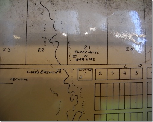
An 1834 map showing the brewery on Queen Street West on the west side of the creek
It appears that John Farr arrived in Toronto in 1818, as it is the first time his name appears in the city’s directory. Henry Scadding stated in his book “Toronto of Old” that Farr emigrated from the north of England, but did not mention the exact place. When Farr arrived at York (Toronto) he and his wife had a son and daughter, both under 16 years of age. In 1819, he purchased 2 1/2 acres of land and built a brewery on the west the bank of Garrison Creek, at the point where the stream crossed Queen Street West. A bridge on Queen Street crossed Garrison Creek in front of Farr house. From this point, the level of the stream dropped 24 1/2 feet to where it flowed into Lake Ontario.
On the north side of Queen Street, a short distance east of the Farr Brewery, was a blockhouse that had been built to defend York during the War of 1812. A short distance to the northwest of the Farr Brewery was the home of Aeneas Shaw, within Park Lot # 22. Shaw led the militia during the defence of York in 1813, when the Americans invaded. The Duke of Kent, father of Queen Victoria, stayed in Shaw’s home when he was in York in 1799. The house no longer exists, but the site on which it once stood is today within Trinity Bellwoods Park.
The 1834 map above shows the brewery, although the name on the map is “Carr’s Brewery.” This is an error, as the Toronto directory does not show anyone by the name of Carr as a resident of York. When Farr built his brewery, from the valley where Garrison Creek flowed through, the brewery was on the slope of the land rising above the valley floor. The site is now level with Queen Street as most of the valley has been filled in with soil.
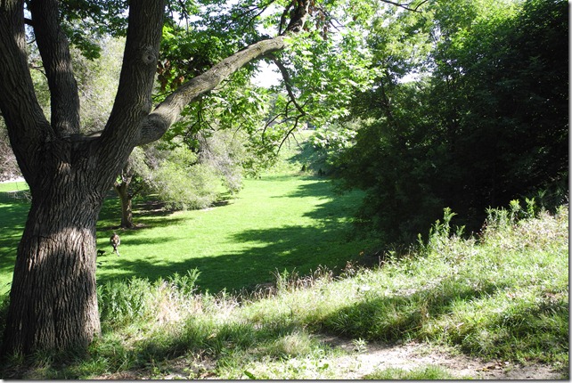
This photo, taken in August of 2012 is from hill above the valley where Garrison Creek once flowed. It is the only section of the valley within Trinity Bellwoods Park that has not been filled in. It is now the area where dogs can run freely.
In Henry Scadding’s book, “Toronto of Old,” published in 1873, on page 261 he describes the brewery as: “. . . a long low-lying building of hewn logs; on the side toward the street a railed gangway led from the road to the door in its upper storey. Conspicuous on the hill above the valley on the western side was the house, also of hewn logs, but cased over with clapboard, of Mr. Farr, the proprietor of the brewery, a north-of-England man in aspect as in staidness and shrewdness of character. His spare form and slightly crippled gait were everywhere familiarly recognized. Greatly respected, he was surviving in 1872. His chief assistant in the old brewery bore the name Bowbeer.”
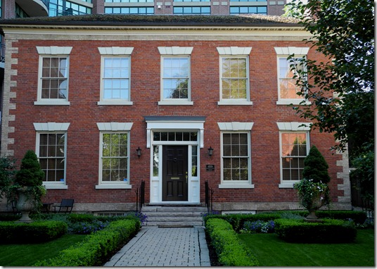
The house on Queen Street today was built in 1847. It is unknown whether the house that Farr had previously built was bricked over, or an entirely new structure was constructed. The house is similar to Campbell House (1822) and the Grange (1818). Because the style of the Farr house pre-dates the era when this style was popular, it is possible that an earlier house was bricked over. The house has nine large rectangular windows in its facade, its design elegant, simple, and exacting. The door has sidelight windows and a transom window above it.
When Farr built his home in 1847, its location was considered remote from the town of York. Similar to most families that resided in the hinterlands, the Farr family attempted to be as self-sufficient as possible. This necessitated that they maintain a kitchen garden, containing turnips, melons, onions, cabbages, potatoes and carrots. A small orchard and a row of beehives were also essential. A short distance from the house there was a stable, as horses were necessary to transport the ale to York along the dusty roads. A barn would also be essential to house the carts and the sleds for winter travel along Queen Street, which would be unplowed. A shed would store tools and perhaps also provide space for an office to keep the brewery accounts.
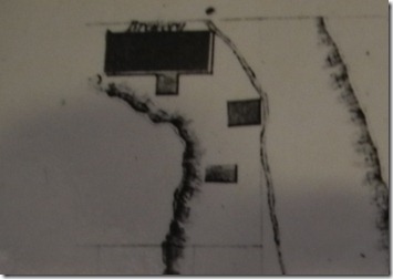
The map above shows the configuration of the buildings on the Farr property in 1858. The largest building is the brewery and it is situated close to Queen Street. The dark lines on the left and right of the map represent the highpoint of land on the edge of the valley. The thin dark line in the centre of the map is Garrison Creek.
John Farr sold his brewery in 1858, but retained ownership of the house. After his death, Farr’s widow, Mrs. Mary Farr lived in the home. Their daughter, Miss Mary A. Farr resided in the home until 1905.
To access others posts about Toronto’s architectural heritage on this blog, https://tayloronhistory.com/
Author can be contacted at: [email protected]

One thought on “Exploring Toronto’s architectural gems -The Farr House at 905 Queen Street West”